 |
Town/City: |
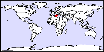
Valletta |
State/Province: |
Malta |
Country: |
Malta |
Latitude/Longitude: |
35°45'N 14°30'E |
Information supplied byAlexis Gutierreza.gutierrez@brgm.fr
Dated Wed Jan 8 13:15:54 2001 |
|
|
Town/City: |
Valletta |
State/Province: |
Malta |
Country: |
Malta |
Latitude/Longitude: |
35°45'N 14°30'E |
Information supplied byAlexis Gutierreza.gutierrez@brgm.fr
Dated Wed Jan 8 13:15:54 2001 |
|
Valletta, capital of the Republic of Malta is located in the largest Island (246 km2) of the Maltese archipelago, in the middle of the Mediterranean sea. Valletta is a very small town, but the urban development has been so intense during this century that the urban area around Valetta is close to 50 km2. The size of the urban area is thus huge compared to the size of the island. Therefore this page will present the water resources of the island of Malta. Malta has a population of about 330000 unhabitants and therefore one of the highest population density (1340 /km2). The island is rather small: about 15 km wide and (max)30 km long.
Mediterranean climate (winter rain, summer drought). The average annual rainfall (Luqa Airport , Met.Office, 1929/30 to 1991/92)is of 579 mm. The minimum occured in 1947/48 with 237 mm. The Maximum in 1951/52 with 924 mm. The average rainy day per year is 85 (mainly between October and April). The mean daily temperature (average 1923-91)is 18.7°C. Min. 9.9°C Feb 1929, Max 28.1°C July 1988. Relative humidity (average 1951-1991)is 75.4%. The potential evaporation computed with Turc formula (1929/30 - 1991/92) = 1298 mm. The potential evaporation computed with Penman formula (1929/30 - 1991/92) = 1391 mm
The island of Malta is made of reef limestone of tertiary age. The main aquifer is thus a karstic aquifer, named Main Sea Level Aquifer (Morris 1952), or Mean Sea Level (other authors). This MSL aquifer contains a water body, with a highest potentiometry of about 3 m. AMSL. It is a fresh water lens, bordered by sea water (except on the North West side where a structural accident constitutes a no flow boundary). This fresh water lens used to be higher in the past, but is now depleted by heavy withdrawals. The MSL aquifer
Groundwater resources constitutes less than 45% of the fresh water supply. The remaining 55% is desalinated water (about 20 million cm). The water table is located between 10 to more than 100 m. deep. It is used by farmers where it is not to deep (northern side of the island). Elsewhere, groundwater is tapped by boreholes and galleries. There is about 7 km of underground galeries located at sea level, with a small deep towards pumping stations.
Due to the absence of natural protection, and the presence of sea water all around it, the fresh water lens is highly vulnerable. The Maltese government is aiming at maintaining low salinity in the supplied water. This is being done by mixing water from Reverse Osmosis Plants and "brackish" groundwater. Although it would be advisable to reduce pumping, the demand is still very high and can't be satisfied with less groundwater withdrawals. (one must add to the maltese population about 1 million tourists per year, staying 12 days on average).
Contamination of water by agricultural practice, wild dumping, sewage leakages result in high nitrate contents: average 1989 groundwater from boreholes = 68 mg/l. Saltwater intrusion problems along the northern shore, and in the middle of the islands (upconnings beneath pumping stations) Average 1989 from Pumping Stations : 1490 mg/l
Use of groundwater protection zones to protect potable supplies. Water treatment, Mixing, Dilution in reservoirs before distribution. This is already being done but not everywhere. Sound Groundwater Management using a model. The model allows to compute the safe yield, knowing the quantity of rainfall of the past year. In 1990 such a model was built (BRGM 1990), but the satisfaction of the water demand often did not allow to follow its suggestions. leads to
MORRIS T.O. (1952) The water supply resources of Malta.
Government of Malta. 125 p.
GUTIERREZ A. (1994) Assessment of the fresh water resources
of the island of Malta. PhD Thesis. University of Paris VI.
(in French) 324 p. + appendices
WATER SERVICES CORPORATION. Annual Reports
MANGION J. (1994) Application of integrate approach to development,
management and use of Water resources in Malta. UNEP PAP-3/1994/W1/7
CHESNOT C. (1996) Unmanageable natural resource. Hydroplus 64
June 1996. pp 16-23
Back to Topics
Geology: Geology of
Malta
Hydrogeology: ANTEA (BRGM Group)
Water Services Corporation, Qormi Road, Luqa LQA 05, MALTA