Town/City:
|
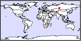
Tomsk
|
State/Province:
|
West Siberia
|
Country:
|
Russia
|
Latitude/Longitude:
|
57 N, 85 E
|
Information supplied by
Andrea Lam
andrea_yk_lam@hotmail.com
96lamand@scar.utoronto.ca
36 Paultiel Drive North York Ontario M2M 3P3 Canada
Dated Tue Dec 14 08:57:25 1999 |
Information Topics:
City Description:
Tomsk is an ancient academic cultural and industrial city located in the
southeast region of West Siberia, on the River Tom, one of the largest
tributaries of the River Ob (Pokrovsky et al., 1998). It is approximately
70 km downstream of the mouth of the Tom River, which is north northwest
of the city (Dubruovoskaya and Zemstov, 1999). The relief of the area trends
west-north-west, which is intersected by the Tom and its associated terraces,
as well as three of its small tributaries: the Ushaika, the Kirgizka and
the Basandaika. South of the Tomsk urban area, the elevations of the interfluve
areas range from 190 - 210 m a.s.l., while to the north of the area, elevations
range from 120-150 m a.s.l. (Pokrovsky et al., 1998). The Tom river valley,
in which the city is situated, lies at elevation of 68-70 m a.s.l. (Pokrovsky
et al., 1998). The city of Tomsk has an area of 154 km2 and
population of 473,000 people (Pokrovsky et al., 1998). The majority of
the urbanization is present on the right bank of Tom river, however there
is some development and a green zone on the left-bank. The historic part
of city consists of two and three story brick houses, while in the newer
neighbourhoods, residential microdistricts are formed from blocks of wooden
five to ten story buildings (Pokrovsky et al., 1998).
Back to Topics
Climate:
The city of Tomsk is located with the humid taiga zone of West Siberia
(Pokrovsky et al., 1998). The climate is moderate, humid, and seasonal
with a long-term average annual air temperature of 0 C and an average annual
precipitation of 600 mm (Dutova et al., 1999).
Back to Topics
Basic Hydrogeology:
The Tom river valley is located on the north east edge of a triangular
shaped catchment area of approximately 2000 km2 between the
northern part of Ob river and Tom river. The catchment area is part of
the West Siberian artesian basin, which consists of overlying sedimentary
rock layers that have a total thickness of up to several hundreds of meters.
The Quaternary surficial landforms are primarily of fluvial origin. Underneath
the rock layers lies the folded Palaeozoic basement of the West Siberian
plate (Dubruovoskaya and Zemstov, 1999). Tomsk has an aquifer complex that
is multi-layered. There is a vertical exchange of water between the aquifer
units and a discharge of water to the surface. Unlithified sandy, silty
and clayey units of Cretaceous, Palaeogene, and Quaternary ages overlie
the Palaeozoic basement aquifer, the deepest aquifer unit (Dutova et al.,
1999). The Palaeozoic aquifer is composed primarily of agrillaceous slates
and lesser sandstones (Pokrovsky et al., 1998). It outcrops in the Tom
river valley, south of Tomsk, and also in the base of the Ushiaka valley.
The components of the aquifer unit that yield water have a total thickness
of 20-80 m (Pokrovsky et al., 1998). The components are located mainly
in the upper part of the unit, in eluvial material, and in number of major
fracture zones. Near the top of the units, a clayey weathering crust is
often developed, which acts an aquitard. The aquifer unit generally has
low water yields and is confined in character with a piezometric surface
ranging between 30-35 m deep (Pokrovsky et al., 1998). In the north and
northwest of the city, the Palaeozoic aquifer occurs at depths of 80-100m
or more (Pokrovsky et al., 1998). The Quaternary aquifer complex includes
the flood-plain and first terrace aquifers, the higher terraces of the
Tom river and its tributaries, and deposits associated with the interfluve
and its slopes (See Figure 3). The lower terrace aquifer contains sand-gravel
deposits of 6-13 m thickness, which are covered by a bed of loams, clays,
silts and interlayers of sand (Pokrovsky et al., 1998). Near the Tom River,
the piezometric surface in these aquifers is close to river level except
for the edges of the terraces where confining pressures of up to 7 m relative
to base of the cover have been measured. Quaternary lower terrace groundwaters
have a high degree of hydraulic continuity with river Tom and Ushiaka (Pokrovsky
et al., 1998). The high terrace aquifer of the Quaternary aquifer complex
lies underneath most of the area between the Tom River and the Ushiaka,
and large areas of the slope of the Tom valley. The deposits that yield
water range in thickness from 8 to 25 m, and consists of sands, sandy loams,
and pebbles (Pokrovsky et al., 1998). The water level depth is dependent
on geomorphological and hypsometric factors, but are generally within a
range of 15-20 m depth within the 3rd and 4th terraces (Pokrovsky et al.,
1998). The base of the aquifers is often characterized by the weathering
crusts of Palaeozoic deposits or by loamy-clayey components of Palaeozoic
or Palaeogene rocks. At base of the terraces, spring lines sometimes emerge
and are particularly strong in the incised ravines of minor rivers (Pokrovsky
et al., 1998). The interfluve aquifer occurs in the eastern part of city.
It consists of sands and sandy loam, and overlies the Palaeogene complex,
which contains sands, silts and clays. The combination of the high relief
of the territory and good drainage results in large depths (usually greater
than 15-20 m) to the water table in these deposits (Pokrovsky et al., 1998).
The interfluve aquifer is distinguished by the presence of a separating
clayey aquifer, without which the main water table would lie within the
Palaeogene aquifer (Pokrovsky et al., 1998). The Palaeogene aquifer complex
lies underneath the entire northern part of Tomsk. The aquifer consists
of many sandy aquifers of varying thickness. Clayey formations separate
the aquifers from each other and from the overlying Quaternary deposits.
At the base of the Palaeogene complex, there is a consistent aquifer (with
a thickness 30-40 m) which is comprised of sands with clay and lignite
interlayers. The depth of this aquifer ranges from 20 m below the Tom river
floodplain, to 60 m below the interfluves. The groundwaters are confined
with piezometric levels near the ground surface within the floodplain and
at depths of up to 70m below the interfluves (Pokrovsky et al., 1998).
In the southern part of Tomsk, Palaeogene deposits occur in patches on
the weathering crust of underlying Palaeozoic deposits. These Palaeogene
deposits have low permeability and consist primarily of silts with interlayers
of clays and brown coals (Pokrovsky et al., 1998). Other minor Palaeogene
aquifers, consisting of feldspar-quartz sands, discharge water from the
riverside slopes (Pokrovsky et al., 1998). The Cretaceous aquifer complex
is widespread within the interfluve between the Ob and Tom rivers. The
aquifer complex consists of three sandy, confined aquifers that are separated
by clays. Where Cretaceous deposits tend to thin out near the Tom river,
one of the upper aquifers is exploited on the right bank in the northern
part of city by many boreholes. The total thickness of sandy aquiferous
horizons is between 20-25 m. The piezometric level is estimated to be 3-5
m above ground level. The Cretaceous aquifer complex is defined by a Paleozoic
weathering crust and separated from overlying Palaeogene aquifers by clayey
aquitards (Pokrovsky et al., 1998).
Back to Topics
Water Use:
For a several decades prior to 1930's Tomsk water supply was obtained from
the Tom river until the development of industry in the Kuzbass region in
upper and middle parts of the Tom river water shed (Dubruovoskaya and Zemstov,
1999). The river became polluted with industry and mining effluents, making
the water unsafe to drink. A new source of drinking water was provided
for the city through the construction of a large groundwater extraction
station located in the catchment area between the Tom and Ob rivers, on
the left bank of the Tom River (Dubruovoskaya and Zemtov, 1999). Many boreholes
that were previously used on the right bank of the Tom river were abandoned,
although some recommenced pumping in later years. By 1973, several high
yielding wells were in use to abstract water from the Paleogene and Palaeozoic
aquifers beneath Tomsk (Pokrovsky et al., 1998). Both groundwater and surface
water are currently being used to meet the water demands of Tomsk: groundwater
for the drinking water supply and industrial-technical supply (Pokrovsky
et al., 1998), while the surface water is primarily used by industry (Dubruovoskaya
and Zemstov, 1999). Since the 1970's, there has been an increase in the
number of wells and total abstraction productivity. The Tomsk extraction
station has become one of the largest in Russia (Dubruovoskaya and Zemstov,
1999), and the current abstraction rate of groundwater is 26 000 m3/day
within Tomsk city boundaries (Pokrovsky et al., 1998).
Back to Topics
Groundwater Issues:
Back to Topics
Groundwater Problems:
In Tomsk there are a number of negative impacts on groundwater quality
and the hydrogeologic regime of the aquifer systems. The long-term exploitation
of the Palaegone aquifer system within the last twenty years has led to
the decrease in the piezometric surface and the deformation of the piezometric
surface into an ellipsoidal cone of depression (Dubruovoskaya and Zemstov,
1999). Boreholes have been abstracting groundwater at different rates -
some for a few hours a day while others have been abstracting continuously.
The decentralized practice of groundwater abstraction has caused a regional
lowering of piezometric levels in pre-Quaternary aquifers and formed a
complicated depressed surface. In northern part of city in Palaeogene complex,
piezometric levels were lowered by 5-6 m, while in southern part of city
in the Palaeozoic formations, regional levels were lowered by 7-8 m (Pokrovsky
et al., 1998). In the same areas it was noted that cones of depression
from separate wellfields were beginning to merge resulting in groundwater
levels 10-15 m below low water level of the Tom River (Pokrovsky et al.,
1998). In contrast, due to the presence of effective aquitards, the decrease
in piezometric levels did not significantly affect the Quaternary aquifers
(Pokrovsky et al., 1998). Observations of large scale dewatering, such
as the disappearance of small lakes in the catchment area, have also been
made on the high plains and the second river terrace (Dubruovoskaya, 1999).
As a result of the impact of urbanization, one of the major changes in
the hydrogeologic regime in Tomsk has been the formation of new aquifer
horizons. New aquifer horizons have been formed by underflooding, which
is caused by rising shallow ground tables beneath historic and newly developed
urban areas (See Figure 4). Underflooding results in a decrease in soil
stability related to the foundation works of buildings, the flooding of
basement structures and the failure of communications infrastructure. In
particular, the Quaternary aquifer system exhibits a tendency towards underflooding.
The tendency may be related to the increased recharge from urban processes
or the impedance of groundwater flow by foundations, and may result in
the formation of perched water tables or rise of water tables into previously
unsaturated materials (Pokrovsky et al., 1998). The primary causes of underflooding
are: a disturbance in water balance in developed and developing areas caused
by leaks from water-supply systems and sewerage and the impeding effect
of deep, piled foundations on ground water flow. Based on waterworks inspection
records, it is estimated that the number of water pipeline leakages is
40-112 per 10 km/year. Leakage losses range from 15-30%. Leakage from pipes,
combined with additional surface run-off from paved surfaces provides an
additional source of recharge to the aquifer system. The intensity of groundwater
recharge depends on the nature of urbanization and water supply conditions.
The estimated additional recharge is estimated to be between 0.01mm/day
and 4mm/day (Pokrovsky et al., 1998). On the lower terraces of the Tom
and Ushiaka rivers, groundwater levels have not been greatly affected by
urbanization due to the characteristic hypsometry of the areas, and the
shallow but permeable nature of the aquifers (Pokrovsky et al., 1998).
The low terraces are adjacent to a zone of naturally intensive groundwater
discharge. Despite the potential for increased recharge from urban processes,
good drainage has prevented rising groundwater levels. The main groundwater
levels of the aquifers of the high terraces and interfluve have also been
relatively unaffected by urbanization due to a high degree of drainage.
The exception is on the right bank of the Ushiaska where rises in levels
of 3-5 m are due to the infilling of ravines where groundwaters were formerly
discharged. In the south of the city, an increase in groundwater levels
of up to 5 m has been observed in area between the Tom and Ushiaska (Pokrovsky
et al., 1998). The flat surfaces of high terraces and the interfluve show
the greatest hydrogeologic impacts of urbanization. The formation of shallow
perched aquifers above the main water tables have been observed on to right-bank
of the river Ushiaska, spreading throughout the north-eastern part and
southern part of the city. The presence of layers and lenses of dense loams
and clays, occurring near the base of sandy deposits aid the formation
of shallow perched aquifers on the 3rd terrace. On the 4th terrace and
the interfluve, shallow perched waters are found mainly at the foot of
loess formations, underlain by low permeability degraded loams. The occurrence
of shallow waters in the north-east of the city is connected with urban
development of interfluve area in 1960s. During that time period, the predominant
system of building involved the use of piled footing (Pokrovsky et al.,
1998). Shallow water in the south of the city is anthropogenic in origin
and occurs in sandy loams and made ground at depths of 1.5-9 m (Pokrovsky
et al., 1998). Over-wet soils have been observed only in isolated locations,
while open brick pits and building foundations remain dry. The disturbance
of surface run-off by construction works, and the impedance of subsurface
waters by foundations and leaks from water pipes have resulted in formation
and spreading of perched shallow aquifers. Therefore against a background
of a limited rise in true groundwater levels, the potential for underflooding
exists, especially where water levels are shallow and where water-yielding
horizons are thin. The major aggravating factors for the problem of underflooding
is the construction of piled foundations, which impede groundwater flow.
Problems with underflooding specifically occur at the breaks of slope such
as junctions between terraces and in areas where groundwater discharges
on the slopes of river valleys (Pokrovsky et al., 1998). Urbanization has
had negative impacts on groundwater quality from different sources including:
the leaching of atmospheric pollutant fallout onto city soil and rock,
the products of urban land use (from landfills and sewage), direct leaks
and spills of contaminants and industrial and urban runoff (Dubruovoskaya
and Zemstov, 1999). Groundwater in aquifers within the city's central area
has the highest concentration of pollution indicators. For example, chloride
concentrations in groundwater from the Palaeozoic and Palaeogenic formations
below the city are 3-4 times higher than background concentrations outside
of city (Dubruovoskaya and Zemstov, 1999). An estimated 40% of urban groundwater
exceeds background chloride value of 10 mg/L (Dubruovoskaya and Zemstov,
1999). These elevated chloride concentrations in deep aquifers illustrates
the high mobility of chloride, and presence of a continuous source of chloride
through use of salt for deicing city roads. The Quartenary aquifer system
appears to be the most negatively impacted since all parameters measured
indicate pollution across a geographically wide area. The average chloride
concentration is 37 mg/L, and 80-90% of urban Quaternary groundwaters has
a higher hardness than water outside of urban area (Dubruovoskaya and Zemstov,
1999). Groundwater abstraction also affects groundwater quality by changing
the thermodynamic/kinetic conditions or gas regime (Dubruovoskaya and Zemstov,
1999). For example, elevated concentrations of sulphate occurs in Palaeozoic
and Palaeogene complexes as result of inflows from higher aquifer horizons
and, in Palaeozoic deposits, sulphide oxidation which is enhanced by groundwater
extraction. (Dubruovoskaya and Zemstov, 1999). On the whole, despite the
presence of groundwater pollution, the city of Tomsk is not subject to
severe groundwater problems due to urbanization. Due to good drainage from
high relief, a network of rivers and ravines dissecting the area and the
presence of thick occurrences of sandy ground, Tomsk does not have serious
problems from high groundwater levels. Hydrogeological problems have only
been incurred in flat-lying high terraces and interfluves where there has
been intensive development (Pokrovsky et al., 1998). The impeding effects
of piled foundations, which exacerbate the problem, are only significant
in areas of high water tables. The basic regime of natural groundwater
flow has not changed significantly despite the lowering of water levels
in deep aquifers due to groundwater abstraction.
Back to Topics
Solutions:
Back to Topics
References and Other Author(s):
Dubruovoskaya, L.I., and Zemstov, V.A., 1999. Some problems of groundwater
near Tomsk, West Siberia, Russia. In Chilton, J., (ed), Proc. XXVII
Congress of International Association of Hydrogeologists, "Groundwater
in the Urban Environment: Selected City Profiles" v. 2 Balkema, Rotterdam,
119-123.
Dutova, E.M., Nalivaiko, N.G., Kuzevanov, K.I., and Kopylova, J.G.,
1999. The Chemical and Microbiological Composition of Urban Groundwater,
Tomsk, Russia. In Chilton, J., (ed), Proc. XXVII Congress of International
Association of Hydrogeologists, "Groundwater in the Urban Environment:
Selected City Profiles" v. 2 Balkema, Rotterdam, 125-130.
Pokrovsky, D.S., Rogov, G.M., and Kuzevanov, K.I., 1998. The impact
of urbanisation on the hydrogeological conditions of Tomsk, Russia.
In Chilton, J., (ed), Proc. XXVII Congress of International Association
of Hydrogeologists, "Groundwater in the Urban Environment: Selected City
Profiles" v. 2 Balkema, Rotterdam, 217-223.
Back to Topics
Contacts:
To be added
Back to Topics