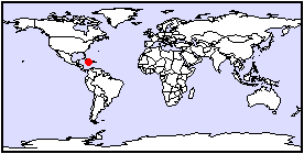
Town/City:
|
Kingston
|
State/Province:
|
Kingston & St-Andrew
|
Country:
|
Jamaica
|
Latitude/Longitude:
|
18N, 76.8W
|
Information supplied by
Isabelle Drouin-Brisebois
Dated Tue Dec 14 04:20:44 1999 |
Information Topics:
City Description:
Kingston, which is the capital of Jamaica, is located on the south-eastern
coast of the island. It had a population of 97,000 people in 1991, and
is situated in the most densely populated region on the island. To the
north of Kingston lie the Blue Mountains which trend along the west-north-west
to east-south-east axis of the island.
Back to Topics
Climate:
Jamaica is subject to tropical marine climate with mean daily temperatures
ranging from a 26 C low in February to a 28 C high in August. The number
of hours of sunshine does not vary very much from 8.2 hours. Most of the
annual precipitation in Jamaica falls on the northern slopes of the mountain
ranges, with southern coastal plains receiving less than 1,500 mm per year.
Much of the precipitation in Jamaica falls in a few very high intensity
and high magnitude events; tropical storms and hurricanes occur quite often
between the months of July and November. The mean relative humidity on
the southern coast ranges from a 71% low in August and a 77% high in October.
Back to Topics
Basic Hydrogeology:
Jamaican geology greatly affects the occurrence and availability of water
resources. Due to the location of the Blue Mountains, the southern half
of the island contains major alluvial lowlands representing 15 % of the
total area of the island. Kingston is located over a thick bed of quaternary
permeable to moderately permeable alluvium which is underlain by tertiary
limestones which have variable degrees of karstification. Because groundwater
is the dominant water resource in coastal alluvial plains, the most important
hydrostratigraphic unit in Kingston is the alluvium aquifer. The aquifer
gets recharge from both rainfall and from rivers like the Rio Cobre which
descends from the mountainous areas and flows over the alluvium region
where seeping and channel losses occur.
Back to Topics
Water Use:
Due to the very high population density, the tourist attractions and the
lack of important agricultural activities in Kingston, the water use is
almost entirely for domestic, industrial and tourism industry purposes.
Back to Topics
Groundwater Issues:
There are many groundwater issues in Kingston. Because of the lack of fresh
water in the form of lakes and rivers in the area, there is a great dependence
on groundwater as a resource. The more prominent issues are: groundwater
supply and resource management, water quality and health related issues
as well as environmental issues.
Back to Topics
Groundwater Problems:
The main groundwater problems in Kingston are:
1. Lack of recharge areas due to urbanisation without proper groundwater
resource planning.
2. Contamination by sewage which can lead to outbreaks of dysentery
and cholera.
3. Pumping at a rate that results in recurring water shortages in dry
seasons causing economic losses and conflicts among water users
Back to Topics
Solutions:
In 1995, the Water Resource Act (WRA) was passed in Jamaica. The WRA has
as a mission:
- the continual assessment and proper management of water resources
- the promotion of conservation and protection
- the promotion of optimal development
- ensuring that the water supply is adequate and resolve conflict between
industry and other water users
The WRA has resulted in a detailed proposed plan of action which includes:
- taking an inventory of resources and demands for domestic, industrial
and touristic use
- establishing water quality control areas
- abstraction licensing
- groundwater risk mapping (mapping groundwater vulnerability to contamination)
Back to Topics
References and Other Author(s):
Bryce, R., 1986, A geotechnical classification of Jamaican rocks;
in Proceedings of a workshop on the status of Jamaican geology, Kingston
March 1984, (ed.) Ahmad, R., The Geological Society of Jamaica.
Jackson, T. A., 1986, The petrology of Jamaican cretaceous and tertiary
volcanic rocks and their tectonic significance; in Proceedings of a workshop
on the status of Jamaican geology, Kingston March 1984, (ed.) Ahmad, R.,
The Geological Society of Jamaica.
Kurian, G. T., 1992, Atlas of the Third World Second Edition, Facts
on File, NY.
Walters, M. O. and Herbert, T., 1998, Application of a linked watershed
waterbody model to Kingston Harbour in Jamaica; in Hydrology in the Humid
Tropic Environment, (ed.) Johnson, A. I. and Fernandez-Jauregui, C. A.,
IAHS Publication no. 253.
Back to Topics
Contacts:
For interesting historical facts on Jamaica:
www.rootsweb.com/~jamwgw/map1.htm
For information on the Water Resource Act and geological and hydrogeological
information on the regions of Jamaica:
www.wra.ja.org/act.htm
www.wra.ja.org/devplan.htm#plan
www.wra.ja.org/jamaica.htm
www.wra.ja.org/riskmap.htm
www.wra.ja.org/policy.htm
www.wra.ja.org/policy.htm#2
Back to Topics