Town/City:
|
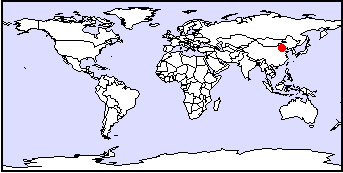
Beijing
|
State/Province:
|
Hubei
|
Country:
|
China
|
Latitude/Longitude:
|
39 50 N 116 20 E
|
Information supplied by
Lily Fung
Dated Wed Dec 2 05:27:23 1998 |
Information Topics:
City Description:
Beijing is the capital of the People's Republic of China, situated in the
north-east of the country. It is the centre of cultural, political, business
and financial activity of this rapid growing developing country. Beijing
is an independent municipal district with a population of 12 million. The
area of the city is 16808 square kilometres, stretching 160 km from east
to west and over 180 km from north to south. There are 18 districts and
counties in Beijing City, Dongcheng, Xicheung, Xuanwu and Chongwen are
near the city, Chaoyang, Haidian, Fengtai and Shijingshan in the suburbs
and Fungshan, Mengtongon, Changping, Tongxian, Shunyi , Daxing, Huairou,
Miyun, Pinggu and Yianging in the outer suburbs. To the north-west, east
and west, Beijing is surrounded by mountains, while the centre and southern
part of Beijing is flat land.
Back to Topics
Climate:
Beijing has a continental temperate climate, with a cold, dry winter, and
wet and warm summer. An air mass from Siberia passes Mongolia during winter
bringing dry and cold air to the northern part of China. In the summer,
warm and moist air from the ocean brings energy to the continent, causing
precipitation. Precipitation averages 567. 2 mm, 574.4 mm falling on the
mountainous region and 553.3mm falling on the flat land. In January, the
temperature is as low as -4 °C, while July is the warmest, about 26°
C. Average temperature in Beijing is 7° C.
Back to Topics
Basic Hydrogeology:
Beijing lies near the ocean with rivers discharging into the Yellow Sea.
There are 5 river drainage systems running from east to west in the city,
these are the Xau Canal with Sun River; the Chaubai System with Chau River,
Bai River and Huai River; North Canal System and Daiching River System.
Beijing is the meeting point of the zone of anticline of the Yinshang Folding
system, NNE faulting zone of Taihang Mt., and the depressional area of
the North China Plain. The folded area hosts various types of granite;
the North China plain is a basin with Quaternary aged surficial deposits.
Back to Topics
Water Use:
Groundwater in Beijing is drawn both from the granite and the layer of
Quaternary deposits of the North China Plain. The potable water is mostly
supplied by 84 reservoirs of various sizes. The two most important ones
are Gwanting and Mewan, which provide 6% of Beijing City's water use. Beijing
began to mine groundwater in the 1960's, relatively earlier than the other
cities. In 1961 - 1984, the extraction of groundwater was 1.9*10^9 cubic
meters per year. 60% of water usage in China is supplied by groundwater.
Back to Topics
Groundwater Issues:
After the 1970s, rapid growth in industrial development and increase in
population greatly increased the demand of water. Alongside with development,
there is decreasing precipitation and increasing waste water from domestic
and industrial sources. As surface water gets contaminated by improper
wastewater disposal, water supply in Beijing depends more on groundwater
as a water source.
Back to Topics
Groundwater Problems:
Because of the extensive use of groundwater, the water table has declined.
This has resulted a total of 618 mm of subsidence in the north-east part
of the city. Among the 5 river systems, there are 87 rivers contaminated
at various levels.
Back to Topics
Solutions:
-
Explore the potential for exploiting water from the Chaubai River and other
more remote areas.
-
Control the amount of water that is pumped out of aquifer.
-
Decrease the chance of contamination of water by treating waste water.
For example, " The China-Project of the DWQC" is a co-operative project
about re-use of treated municipal waste water, especially for groundwater
recharge.
-
Set laws to protect the water quality and air quality, and
-
Educate people to save water.
Back to Topics
References and Other Author(s):
"The World Atlas", Genuine Books and Stationary Co., Hong Kong, 1973.

Wang, Zhaoxin, Groundwater Resources Development and Utilisation in China, Neimenggu People
 Publishing House, China, 1992. (In Chinese)
Back to Topics
Contacts:
Back to Topics