Town/City:
|
Accra
|
State/Province:
|
Greater Accra Region
|
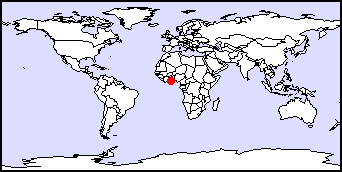
Country:
|
Ghana, West Africa
|
Latitude/Longitude:
|
5N 0E
|
Information supplied by
Julie Ward
Dated Tue Dec 8 11:08:12 1998 |
Information Topics:
City Description:
Accra is the capital and largest city in Ghana. It is located on the coast
of the Gulf of Guinea, in the southeastern proportion of the country and
is therefore a very important commercial, manufacturing, transportation
and communication centre. The Population estimate for 1996/97 is 1.3 million
people in an area of 238.5 square kilometers. Accra has many small businesses
and industries though nothing large scale. The industry includes: sawmills,
furniture making, brick and tile mining, nail production,soap production,
breweries, soft drink bottling, fruit and fish canning and an edible oil
refinery. Accra is located next to the margin of a continental/oceanic
transform boundary and is therefore prone to earthquakes. Due to massive
deforestation and urban development, Accra has very little easily economic
resources. Most of the land is taken up by half built houses and buildings.
Back to Topics
Climate:
Tropical, warm, comparatively dry climate. It is located at the inter-tropical
convergence zone of a tropical continental air mass from the northeast
and a tropical equatorial air mass from the southeast. This creates two
rainfall seasons over Accra. The first one peaks in May/June with approximately
19.8 cm rainfall and the subsidiary season is in October with approximately
6.35 cm. In between the rainy seasons Accra experiences harmattan winds,
hot dry winds from the northeast. Due to Accra's location adjacent to the
ocean the temperature is fairly stable, fluctuating between high 20s and
mid 30s degrees C. Humidity also stays relatively constant at 90-100%,
though can drop drastically in the harmattan season.
Back to Topics
Basic Hydrogeology:
Accra is located in the Accra coastal plains. Its peak elevation to the
north is less than 300 ft and slopes southward towards the Atlantic Ocean.
The drainage has created small scale spoon shaped valleys separated by
low ridges, which follow the sloping topography towards the south. Its
geology consists of underlying Accrainan sandstone, grits and shales.
Back to Topics
Water Use:
Water is needed for physical consumption to sustain a large increasing
population. Accra's main water supplies are piped from a near by coastal
stream, the Densu, where it can be treated. The more rural communities
obtain water from shallow boreholes, wells, ponds, springs and when water
is scarce, it is collected from the ocean. These sources of water are not
treated and generally polluted. Water is needed locally for small scale,
farming, cattle ranging, and industry. It is also extremely important for
electricity which is the country's main source of power.
Back to Topics
Groundwater Issues:
-
The goverment, implementors, and users are adopting different but interrelated
mechanisms to deal with water stress in Accra. Alternative sources of water
are being investigated in order to meet the needs of different users.
-
Located just north and northeast of Accra is the largest man made dam in
the world, the Volta River Dam, constructed in 1964. It has a catchment
area of 165 700 square kilometers. This dam is the main source of power
for over half the country's people.
Back to Topics
Groundwater Problems:
-
Water shortage, therefore leading to power shortage, is due to substantial
increases in population, and drought conditions. Electricity is supplied
from the Akosombo dam, the water supply in its basin is in severe shortage
due to drought, and extensive uncontrollable evaporation. Drought conditions
indirectly lead to problems in agriculture, deforestation, overgrazing,
soil erosion, poaching, habitat destruction, and water pollution.
-
During the rainy season surface runoff is a large problem for those older
comunities that do not have and/or cannot afford sewage systems. Therefore
waters are carried along surfaces and deposited in ponds where main water
sources are obtained.
-
Lack of treated drinking water. This is due to an increase in wastes from
the increased population; with a lack of money and knowledge to fix the
problem.
-
Water born disease, such as cholera and typhoid caused by pollution from
excreta and lack of surface water treatment; therefore pollutants are collecting
in nearby streams, rivers and ponds.
Back to Topics
Solutions:
-
Immediate short term solutions of regulating days for water supply and
electricity (the 3 days on 3 days off method).
-
Reforestation project of the Volta river dam to attempt to control the
evaporation rate and increase storage of water.
-
Local development projects of borehole construction which can serve a large
number of people, compared to the old fashion hand dug well method.
-
Education about proper water sanitation at local schools and surrounding
villages, therefore aiming at reducing the amount of water disease caused
by pollution.
-
Money being supplied to increase the amount of testing and treatment, and
the development of a reduced cost sewage system.
-
Physical increase in flow velocity in channels used for irrigation thereby
controlling snail number, and reducting the chance of schistosomiasis,
a disease in humans caused by ingestion of snail eggs.
-
Design for flood water storage system, that can be reused for irrigation,
therefore making the most of the limited supply of water.
Back to Topics
References and Other Author(s):
Back to Topics
Contacts:
GARNET-D.L.saywell@lboro.as.uk
Robins, N.S.
Hydrogeology Group
British Geological Survey (BGS) Wallingford
McClean Building, Crowmarsh Gifford
Wallingford, Oxfordshire OX 10 8BB
Tel: 01491 838800
Back to Topics